"E SurveyCAD" is a comprehensive and compact software solution for surveyors and Engineers for creating Contours, calculating Earthwork quantities and converting point data into CAD to generate Topographical map.
It comes with three modules listed below:
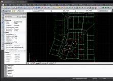
-Topodraw: Generates Topographical drawings from point data instantly with blocks and elevations in their respective Northings and Eastings.
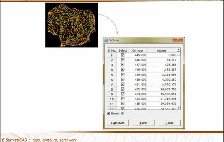
-Contours: Generates smooth contours quickly from point data available in CAD drawings\ Levels available in Excel or CSV files.
-Earthwork: Generates volume calculations and section drawings from point data available in CAD drawings / Levels available in Excel or CSV files.
"E SurveyCAD" also comes with some useful tools like Traverse correction, Units convertor, Bulk Plot, Find duplicates etc. which are easy to use and save a lot of time.
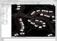
A desktop survey and design program created for surveyors, and contractors.

Comments
Facebook comments